GeoMapPro

Digital Mapping Platform

Transform oil and gas data into professional graphics with one click, lowering barriers and enabling intelligent, cloud-based mapping.

What is GeoMapPro?

GeoMapPro is a next-generation online data mapping platform designed for high-frequency mapping scenarios in the oil and gas industry. Built on unified data, standardized templates, and business objects, it enables one-click generation, online editing, and collaborative sharing of professional maps.


Users can quickly produce domain-specific mapping outputs without complex cartography operations. This transforms the traditional workflow of “searching for data, adjusting templates, and manually drawing maps” into a more efficient, data-driven, template-based, and collaboratively enabled mapping process.

What are the Key Challenges?

Cumbersome Traditional Mapping Workflow

Traditional mapping tools entail a steep learning curve and complex operations, requiring significant time for repetitive drafting tasks, thereby hindering professional analysis and decision-making efficiency.

Difficulty in Managing Drawing and Data Versions​

Multiple data sources and disparate tools lead to inconsistent versions of drawings and varying interpretations of business meanings, making it challenging to quickly retrieve accurate and reliable graphical outputs.

Disconnection Between Graphics and Data Systems​

Visualization systems lack integration with oilfield databases, preventing automatic data-driven mapping. This results in outdated graphical outputs that fail to synchronize with dynamic data updates, impeding continuous analytical iteration.

Limited Application Models​

Most systems are limited to standalone or heavyweight software versions, failing to meet modern oilfield needs for lightweight web-based graphical visualization, real-time collaboration, and intelligent mapping capabilities.

How Do We Solve These?

One Data, All Maps​

Foundation:​ JuraData serves as the unified data source, ensuring all graphical data originates from a single, standardized system.

Coverage:​ Offer a full suite of mapping components to support graphical needs.

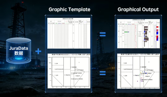
One-Click Mapping Powered by "Data + Templates"​

Leveraging professional templates combined with real-time oilfield data, it enables one-click map generation, delivering order-of-magnitude improvements in efficiency.

Intelligent Linkage and Real-Time Synchronization​

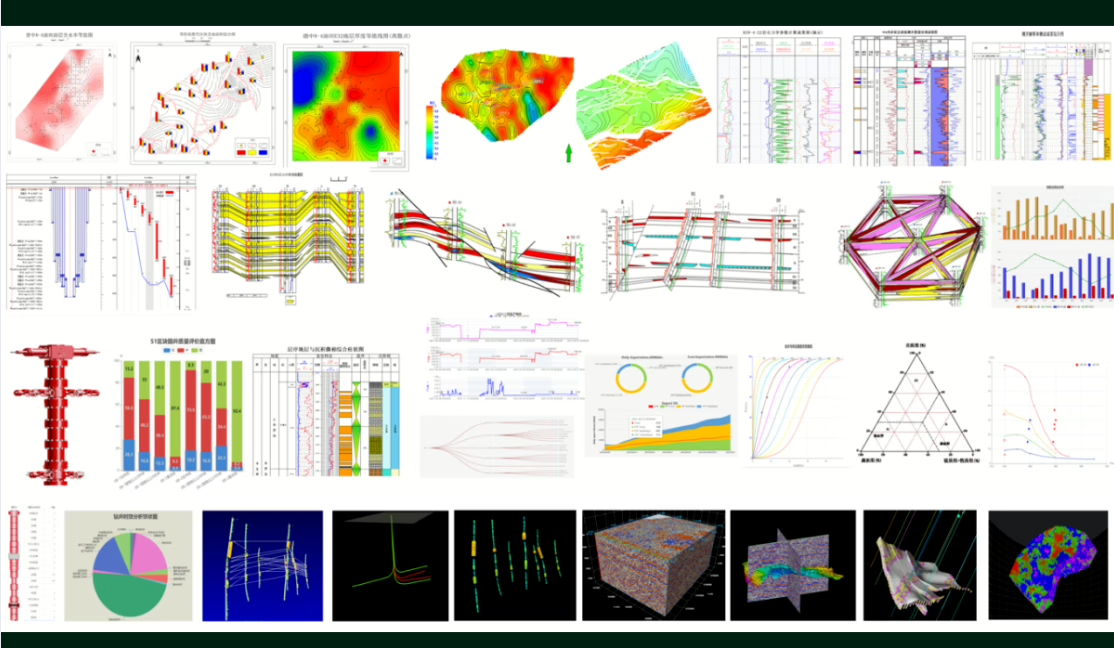
Cross-Map Integration:​ Based on unified JuraData sources, all output maps—such as planar charts, histograms, and profiles—maintain consistent professional interpretations. Data updates in one map automatically synchronize across all connected charts.

Data-Map Linkage:​ It is deeply integrated with the database. Any data changes are automatically reflected in related maps, ensuring visualizations always represent the latest data.

Lightweight Web Application, Flexible and Convenient​

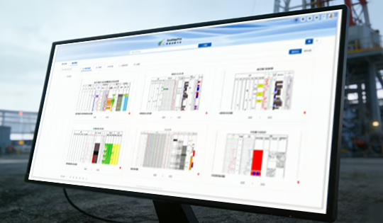
Web-Based Lightweight Solution:​ Feature a "Data + Templates" rapid mapping workflow, requiring no software installation. It offers a convenient and efficient way to quickly view and generate routine report graphics.

Data Compatibility and Seamless Flow​

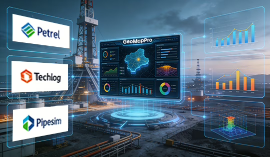
The product offers robust data conversion and adaptation capabilities, supporting and reading data formats from a variety of leading professional software applications (such as Petrel, Techlog, Pipsim, etc.). This ensures the seamless transfer and smooth integration of users' existing data resources.

Professional Standards and Superior Visualization​

Visualizations are designed in compliance with industry graphical standards, ensuring output results meet industrial mapping specifications. Equipped with a powerful graphics rendering engine, it delivers precise, polished, and high-performance display effects, significantly enhancing the quality of graphical visualizations.

Core Business Scenarios for the Oil and Gas Industry

Online Data Mapping and Intelligent Map Viewing

GeoMapPro is designed for high-frequency mapping scenarios across research institutes, oil production plants, development management departments, and production command centers. It provides technical personnel with rapid map production capabilities and equips management users with real-time map viewing capabilities, enabling full-process online workflows for map creation, sharing, and application.

Challenges

Solution

Technical Advantages of GeoMapPro

Coupled with deeply embedded domain-specific algorithms, the one-click mapping feature improves efficiency by orders of magnitude, allowing experts to focus on core analytical work. Supported by consistently reliable and real-time updated data, the system ensures end-to-end decision-making accuracy and coherence, driving cost efficiency and risk reduction in oil and gas exploration and development.

Core Technology: Built on the innovative JuraData integrated data lake, it solves multi-source heterogeneous data integration challenges.

Advantage: All visualization applications operate on a single, authoritative, clean data source, ensuring consistent data origins and reliable foundations for intelligent applications.

Core Technology:​ Feature an advanced graphics linkage rendering engine and a Change Data Capture (CDC) mechanism, based on a unified data model and event-driven architecture.

Advantage: Achieve real-time data-graphics synchronization (graphs update as data changes) and intelligent inter-graphic coordination (edit in one graphic sync across all related graphics), ensuring consistency and freeing engineers from repetitive manual updates.

Core Technology:​ Embed domain-specific algorithm libraries closely aligned with oilfield workflows, such as smart contour tracing, well-path design, reservoir parameter interpolation, fault auto-identification, and sedimentary facies prediction.

Advantage: Ensure graphics are not just drawn but computed, producing accurate and reliable geological outputs—from structural maps to reservoir models—that combine expert knowledge with computational power.
Value for Our Clients

Promote the standardization of mapping outputs

Enable real-time linkage between maps and underlying data

Facilitate result sharing and knowledge consolidation

Support self-service map viewing for executives and managers

GeoMap Product Suite Overview

The GeoMap series is a full-scenario graphics production and intelligent visualization product suite for oil and gas exploration and development. It is not a single mapping tool, but a comprehensive solution covering desktop precision cartography, web-based data mapping, and AI-driven natural language mapping. It supports oilfield enterprises in evolving from traditional map drafting and annotation-based workflows to intelligent and automated map production.
Product NameCore PositioningCore Mapping ModeCore ValueDeployment ModeTypical Users
GeoMapDesktop professional precision mappingTemplate + data-driven mapping (database-connected)Complex map refinement, standardized publishing, and professional deliverablesDesktop (C/S)Professional cartographers responsible for map standardization, refinement, and publishing
GeoMapProWeb-based data mapping platformTemplate + object data one-click mappingOne-click mapping, online sharing, and data-map linkageWebR&D institutes, oilfields, and production command teams
GeoMapXAI-powered mapping platformNatural language mapping and editingAI-driven mapping and real-time meeting visualizationWebTeams exploring AI-driven workflows

Ready to Step into Digitalization?