Intelligent Mapping Platform
Intelligent Mapping Platform
Generate and edit geological maps with natural language, automating complex tasks and making professional cartography accessible.
GeoMapX is a next-generation AI-powered mapping platform developed by Jurassic Software for the oil and gas exploration and production sector. With natural language interaction at its core, users simply describe their mapping needs in business terminology, and the system automatically identifies the map type, business objects, data scope, and styling requirements to rapidly generate professional maps. GeoMapX can be widely applied to high-frequency scenarios such as wellsite justification, dynamic analysis, reserve assessment, and plan discussions. It supports ad-hoc map viewing, instant map generation, and intelligent map editing, and can be used in conjunction with GeoMapPro and GeoMap to form an intelligent mapping workflow characterized by “AI-generated, online-shared, and professionally refined” maps.
Traditional professional mapping software requires extensive training, often forcing geoscientists to focus on tool operation rather than geological analysis.
Even with prepared data, creating maps involves lengthy steps, including parameter setting, menu navigation, and manual adjustments, making it difficult to keep pace with evolving research insights.
Visualization systems are disconnected from enterprise databases, making automatic data retrieval difficult and preventing graphics from staying synchronized with data updates and analytical insights.
Traditional standalone or heavyweight applications cannot effectively support lightweight web visualization, real-time collaboration, or intelligent graphics generation, limiting efficiency and user experience.

Natural Language Interface
Users express mapping needs through spoken or professional descriptions, and the AI engine automatically interprets the intent and converts it into executable mapping commands, enabling “what you say is what you get.”
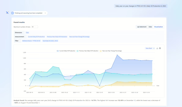
AI-Driven Automated Map Creation and Editing
Based on deep learning of domain knowledge, the AI engine leverages the platform’s robust data-driven mapping logic, standard templates, and editing capabilities to automate the entire process—from data filtering and parameter configuration to map generation and style optimization.
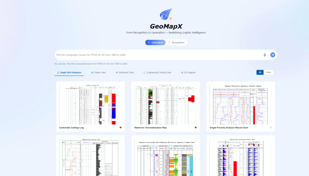
Inherited and Enhanced Standardization Framework
It fully adopts the industry standards and professional templates built into GeoMap, ensuring that AI-generated maps inherently comply with established norms. These standards are also embedded into the AI model to guarantee professional-quality intelligent outputs.

Data–Graphics Integration
GeoMapX is deeply integrated with JuraData, automatically synchronizing data changes with related graphics to ensure they always reflect the latest information.
A stable underlying architecture integrates GeoMap’s proven graphical algorithms and standardized resource library to ensure the professional accuracy of map generation, while an upper-layer AI engine handles intent comprehension and task orchestration, achieving deep integration of intelligence and expertise.
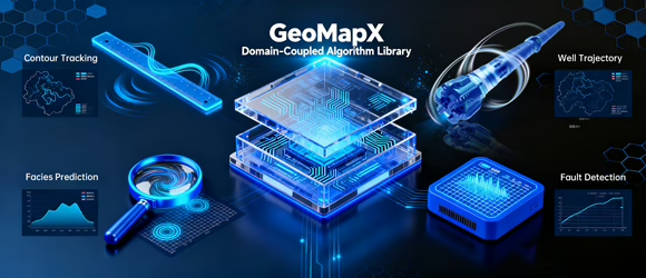
Specially trained and optimized for petroleum geology terminology, map types, and workflows, it accurately interprets users’ professional intent rather than engaging in generic dialogue.

Ambiguous natural language requests are automatically decomposed and transformed into a series of precise platform API calls and parameter configurations, seamlessly driving the backend mapping workflow.

Support complex edits to existing maps, such as partial modifications, style adjustments, and element addition via natural language. The AI comprehends graphical context and executes operations accurately.

GeoMapX is designed for technical meeting scenarios such as well-site feasibility studies, dynamic analysis, and reserve evaluations. It enables experts to quickly express their mapping needs using natural language, and the system automatically interprets their business intent to generate professional maps, helping meeting participants obtain results instantly whenever visual support is needed.
Challenges
Solution
| Product Name | Core Positioning | Core Mapping Mode | Core Value | Deployment Mode | Typical Users |
| GeoMap | Desktop professional precision mapping | Template + data-driven mapping (database-connected) | Complex map refinement, standardized publishing, and professional deliverables | Desktop (C/S) | Professional cartographers responsible for map standardization, refinement, and publishing |
| GeoMapPro | Web-based data mapping platform | Template + object data one-click mapping | One-click mapping, online sharing, and data-map linkage | Web | R&D institutes, oilfields, and production command teams |
| GeoMapX | AI-powered mapping platform | Natural language mapping and editing | AI-driven mapping and real-time meeting visualization | Web | Teams exploring AI-driven workflows |
Quick Links
About Us